The territory of Baunei unfolds along the Eastern-Central strip of Sardinia, in the province of Nuoro and constitutes, both historically and geographically, the northern border of the region of Ogliastra. In fact, its Northern border is along the unspoiled Codula Elune, which reaches the breathtaking Cala [Cove] by the same name.
The town was established on a limestone ridge facing South-West, and is crossed by the Orientale Sarda [Eastern Sardinian highway] (SS 125) connecting it to the village of Monte Colcau.
The hamlet of Santa Maria Navarrese is located eight kilometers from the village overlooking the sea, bordering the town of Lotzorai. The people of Baunei built the village of Santa Maria Navarrese, with its ancient name linked to the distant history of the Middle Ages and legend, after 1950. The symbol of this town, cherished by the people of Baunei, is the medieval church located at the center of the main square, surrounded by majestic and fascinating centuries-old olive trees. According to legend, the Princess of Navarra commissioned the small church in honor of the Virgin Mary after surviving a sinking ship.
Topping the tourist port of Santa Maria Navarrese is a white cylindrical tower and an outer L-shaped breakwater complete with six piers. Baunei has always enjoyed a carefully balanced economy between the municipally owned and privately owned land. The special care for the environment and the territory perpetuated over time by the people of Baunei, has allowed for protecting and keeping 40 kilometers of coast unspoiled and a unique hinterland that offer visitors a mix of turquoise and emerald landscapes, created by the sea and the mountains.
Every place in Baunei nourishes the soul, from the mysteries of Golgo to the crystal-clear water of our coves, from the unveiled enchantment of Pedralonga to the stillness of Santa Maria Navarrese. A vast territory, facing the Tyrrhenian Sea to the East, bordering the municipality of Lotzorai to the South, and those of Triei and Talana Southwest, bordering Northwest with the territory of Urzulei, and to the North, near the coast, with Dorgali, along a line marked by Codula di Luna, which also runs along the Northern border with Urzulei. At the summit, the overlying limestone rampart ending with a sub-level surface located in the vast subsidence of Golgo (filled by flowing basaltic lava during the Quaternary period), is one of the most distinctive areas of the "Mountain-summit world".
From its 480 meters above sea level, Baunei overlooks the Ogliastra letting eyes wander on what might be termed "the amphitheater of mountains" dominated by the highest peaks of the Gennargentu. The municipality is a place almost entirely situated at an altitude above 400 meters. The territory is ridged by narrow, deep valleys known locally as "codule", that flow into the sea cutting off the steep limestone backdrops, in a landscape characterized by rocks, cliffs and deep gorges. Forty kilometers of ramparts and limestone cliffs, occasionally giving way to small coves, is what makes the wild and rugged Sardinian coastline unique and highly distinctive, but truly charming. In fact, the Gulf, dominated by limestone mainly consists of high cliffs falling into the deep water. It is here that the Supramonte of Baunei [Mountain summit of Baunei] ends: a huge slope that juts out into the Tyrrhenian Sea into the clearest blue sea, becoming the backdrop for the beautiful beaches. These include, for example, Cala Elune and Cala Sisine, which are the end points of the "codule" or deep valleys by the same name and create the unique landscapes, typical of this coast. In addition, the spectacular rock architecture overlooking the turquoise blue sea with high white cliffs is a destination spot for those who love climbing. This area with such rich natural value beckons for many reasons: in fact, the network of hiking trails that lead to Cala Goloritzè, Ispuligedenie, Cala Biriala, Ilune (Cala Luna) and Cala Sisine, unravels from Golgo, with the nearby "su Meràculu" cave, one of the karst caves that can be visited, along with the Grotta del Fico, the latter reachable by sea. The network of trails is even more enhanced in Pedralonga, the starting point of the famous “Selvaggio Blu” trekking, offering five days of cliffs, abseiling, ancient sheepfolds, woodlands and natural caves: a unique setting, ideal for climbing. All along the coast the thick vegetation, characterized by formations originating from primary Mediterranean forest, is dominated by the Maquis shrubland and by the fascinating specimens of centuries-old holm-oaks.
Junipers are found everywhere with their ancient and gnarled trunks sprouting from the cracks of the rock in the most precipitous cliffs, or grouped in a bush formations that dominate the entire Capo Monte Santo. This area is the ideal habitat for significant rare species: several specimens of Monk Seal live in these seas; also noteworthy, is the presence of Eleonora's Falcon, which has established the largest colony in the Mediterranean in these areas. Lastly, this coast is one of the areas populated by Audouin's gulls, which are an extremely significant ecological indicator whose nesting specifically indicates the exceptionally healthy state of the environment chosen. The marine ecosystem is still intact and in good health: the extensive significant underwater seagrass and Posidonia oceanica meadow formations live all along the coastline up to a depth that would be prohibitive elsewhere for these species.
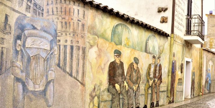
A crossroads of land and sea, a hillside village suspended between the white Mountain summit and the blue Navarre sea, Baunei can be distinguished by the pieces of its history, recognized in the ancient houses, in the local dialect, in the traditions that still live on today. A simple history, spanning the stillness of centuries, never marred by ambitions for revenge, almost an ode to peace, ab antique, from Nuragic origins to the auspices of the Romans, up to the centuries of the Spaniards and Savoy kings.
The landscape has a strong savage connotation and the combination of sea and mountain culminates in a natural union of outstanding value, enriched by a strong cultural heritage. Of specific interest, archeologically speaking, are the traces of Sardinian culture, particularly those found in Golgo, the largest karst plateau protected by Nuraghis overlooking its accesses, almost to preserve its mysteries, also concealed in its natural formations, from the deep black abyss of "su Sterru" (the deepest single span in Europe) to the emerald green waters of "as piscinas".
Among the nuraghi of Golgo, Co'e Serra is probably the best known: erected to guard the plateau, its white presence on a low rocky prominence, is in perfect geometry with the neighboring areas of Orgoduri and Alvu, nuraghi not far from the Church of San Pietro. Built during the second half of the seventeenth century, the church has a legendary history, naming the Holy Apostle Peter as the great protector, who freed the population from the threat of "su scultone", the monster who lived in the chasm of Golgo, whose ire could only be appeased in exchange of young virgins. Opposite the church is a prominent anthropomorphic Betile unlike any others in Sardinia.